
This Programmatic Environmental Impact Statement (EIS) was developed to evaluate the potential significant environmental impacts of multiple geological and geophysical (G&G) activities within Federal waters of the Gulf of America’s (GOA) Outer Continental Shelf (OCS) and adjacent state waters.
The Bureau of Ocean Energy Management (BOEM), with the National Oceanic and Atmospheric Administration’s (NOAA) National Marine Fisheries Service (NMFS) and the Bureau of Safety and Environmental Enforcement (BSEE) as cooperating agencies, prepared a Programmatic EIS pursuant to the National Environmental Policy Act (NEPA). BOEM and NMFS intend for this Programmatic EIS to provide the necessary documentation and analyses to support informed decisions regarding future Outer Continental Shelf Lands Act (OCSLA) Permit and Marine Mammal Protection Act (MMPA) Authorization actions related to G&G activities on the OCS. In addition, the preparation of this Programmatic EIS will help to ensure compliance with other applicable laws and statutes such as the Endangered Species Act (ESA), Magnuson-Stevens Fishery Conservation and Management Act (MSFCMA), Coastal Zone Management Act (CZMA), and the National Historic Preservation Act (NHPA).
Final Programmatic EIS
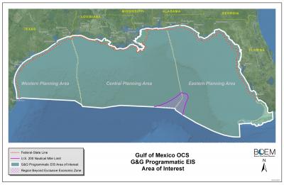
Gulf of Mexico OCS Proposed Geological and Geophysical Activities; Western, Central, and Eastern Planning Areas; Final Programmatic Environmental Impact Statement OCS EIS/EA BOEM 2017-051 (Volume 1, Volume 2, Volume 3, Volume 4)
Final Record of Decision
Record of Decision for Gulf of Mexico Outer Continental Shelf Proposed Geological and Geophysical Activities Western, Central, and Eastern Planning Areas Final Programmatic Environmental Impact Statement
Additional Information
- Acoustic Propagation and Marine Mammal Exposure Modeling of Geological and Geophysical Sources in the Gulf of Mexico
- BOEM ESA Information Sheet
- BOEM MMPA Information Sheet
- Brief History of the Use of Sound in Ocean Exploration (USGS, Woods Hole Coastal and Marine Science Center)
- Brief Tutorial on Seismic Technology and How It Is Used (USGS, Woods Hole Coastal and Marine Science Center)
- Civil Action No. 2:10-cv-01882 Settlement Agreement
- Geological and Geophysical Exploration for Mineral Resources on the Gulf of Mexico Outer Continental Shelf: Final Programmatic Environmental Assessment (OCS EIS/EA MMS 2004-054)
- G&G Regulatory Authority Information Sheet
- Gulf of Mexico Region, Non-Proprietary Geological and Geophysical (G&G) Permitting Information (NRDC Settlement Agreement)
- Marine Debris is the GOM (NMFS PowerPoint Presentation)
- NMFS ESA Fact Sheet
- NMFS Marine Mammals and Noise Fact Sheet
- NMFS MMPA Fact Sheet
- Oil and Gas Development Fact Sheet
- Protected Species in the GOM (NMFS PowerPoint Presentation)
- Project Information Sheet
- Renewable Energy Fact Sheet
- Seismic Survey Mitigation Measures and Marine Mammal Observer Reports (OCS Study BOEM 2012-015)
- Webinar Synthesis Report: Marine Mammal Monitoring for Geological and Geophysical Activities in the Gulf of Mexico