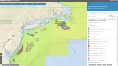
MarineCadastre.gov is a powerful map and data delivery system designed to help users to find the most up-to-date, authoritative map data within coastal and offshore waters of the U.S.
MarineCadastre.gov primarily provides authoritative source data at large regional or national scales. It expanded its data themes beyond the typical “cadastral” layers long ago to cover most of the data layers needed in the initial planning stages for many offshore and coastal projects. The system includes over 300 layers that can be downloaded from or viewed on the system’s map viewer or can be ported to an ArcGIS Online viewer enabling the users to add other data sources and save their maps for their own needs.
Whenever possible, the map service layers available through the registry and map viewer are provided directly from the agency of responsibility, helping to ensure that users get the most up-to-date version of the maps possible. However, many map layers were created by the MarineCadastre.gov team because the original data is not made available in a map service format by the source. In these cases, the map layers are updated on an as-needed basis.
By making many data layers available using map service technology, the system not only feeds its own tools, data registries and viewers, but also those of other similar systems such as state, regional and special interest portals that utilize many of the authoritative map layers maintained and updated by the MarineCadastre.gov project team. The MarineCadastre.gov system also provides links and additional information to many of the well-known regional mapping data portals.
MarineCadastre.gov was developed in 2009 in response to the Energy Policy Act of 2005, which called for such an authoritative mapping data source. The system and related tools are maintained and updated through an interagency agreement between BOEM and NOAA, See the Executive Summary of the Implementation Plan for the Multipurpose Marine Cadastre for more information.
This web-based interactive tool for ocean mapping and planning provides everyone from ocean industries to coastal managers, students and the general public, the opportunity to be an ocean explorer right from their own computer.
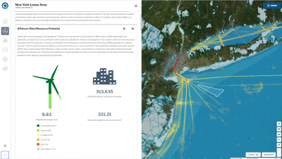
The OceanReports web tool, provides users specialized “ocean neighborhood analyses” including maps and graphics by analyzing more than 100 ocean datasets instantaneously based on a polygon drawn by the user.
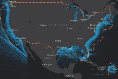
Direct access to U.S. vessel traffic data just became easier. AccessAIS, an innovative tool found on the MarineCadastre.gov platform, provides custom, "clip and ship" access to over 25 billion vessel locations spanning a decade. The information provided by this tool is an integral part of project planning and siting and can be used to promote safe use of ocean space.
This tool helps provide a large volume of data in a seamless and efficient manner, while placing more control within the user's hands. Using the intuitive interface, users are able to tailor data access to their area and time period of interest. The tool allows users to draw their own areas of interest and quickly download targeted vessel traffic data or access bulk data for larger areas. Through the approach of filtered data processing and simplified data access, AccessAIS helps maximize the value of AIS data to the maritime and geospatial communities.
A partnership between NOAA, the Bureau of Ocean Energy Management, and the U.S. Coast Guard helped create this tool.
ESRI Living Atlas – US Vessel Traffic Map is showcasing the MarineCadastre.gov AIS data resources. You can even download some of the data from there.
Definitions:
Cadastre
a record of property and contains information at the parcel level about legal boundaries, usage, rights, and restrictions. A marine cadastre contains similar information about ocean space.
Authoritative Source
usually a federal or state government agency or a group designated by the agency to create information to meet mission requirements mandated by law or policy. For data, this means that the agency, state, or other jurisdiction is responsible for the collection or creation of information in order to meet a mandated requirement or policy. For instance, the Coast Guard is responsible for determining where official shipping traffic lanes (routing measures) should exist, and NOAA is responsible for making this data available on Navigational Charts. Because NOAA is getting the authoritative data from the Coast Guard’s descriptions in the Code of Federal Regulations, the MarineCadastre.gov references that particular data layer from NOAA Charts.
Map Service
is a geospatial data product that is streamed over the internet by a source server that responds to requests through application APIs based on users requests. Requests are actions like zooming in and out of the map, turning layers on or off, or clicking on features to find out attribute information. These images are typically produced by a map server from data provided by a GIS database.
Documented Uses
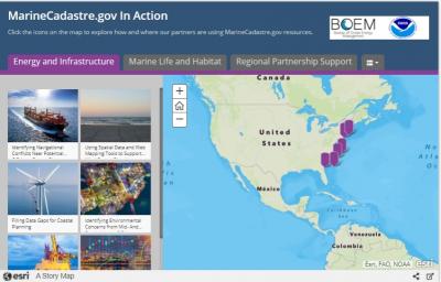
While it is often hard to know who is using an online tool, the MarineCadastre.gov team has put together a story map of documented uses of the tool.
Videos
- 1-minute intro video for OceanReports
- 1-minute video on using OceanReports
- MarineCadastre.og Basic How to Video Guide (7 minutes)
- Maps and Tools for Communicating, Information Gathering, and Commenting (Intro to both MarineCadastre.gov and OceanReports & Recorded Powerpoint and demo of how to use OceanReports) (13 minutes)
Instructions
- Creating Map Images for Commenting in Regulations.gov
- MarineCadastre.gov Web Services – Frequently Asked Questions
Handouts
Awards
Recent Updates
Who to contact:
For questions and suggestions – email us at info@marinecadastre.gov
Related tools
Other BOEM Tools
- ESPIS (Environmental Studies Program Information System)
- Marine Minerals Information System
- BOEM Data Center (primarily oil and gas information)
Regional Ocean Partnerships – MarineCadastre.gov has representatives that coordinate data needs and leverage opportunities with the regional ocean partners.
- Mid-Atlantic Regional Council on the Oceans (MARCO) Mid-Atlantic Ocean Data Portal
- Northeast Regional Ocean Council’s (NROC) Northeast Data Portal
- West Coast Governors Alliance on Ocean Health West Coast Ocean Data Portal
- Data Basin – California Offshore Wind Energy Gateway
IOOS - Many of the US regions do not have large specialized offshore geospatial data portals available. Systems such as the 11 regional Integrated Ocean Observing System (IOOS) networks often consolidate much of the data for those regions. A map with links to each region can be found here.
Other Geospatial Data Resources
- Digital Coast – Contains data, tools, and resources for ocean use, among other topics.
- Geoplatform.gov – Hosting many of MarineCadastre.gov’s maps.
- Tethys – Facilitates data and information sharing on the environmental effects of offshore-wind and marine and hydrokinetic energy development.
- NREL – Marine Energy Atlas
- SECOORA Sand Management Information


