The Renewable Energy Program develops, maintains and uses GIS data for a wide range of activities related to planning, assessment and environmental review of renewable energy projects on the Outer Continental Shelf. This page provides direct access to data that the program has developed or maintains. GIS compatible data is in shapefile, raster, text/tabular or geodatabase format.
Wind Planning Areas, Wind Energy Areas and Renewable Energy Leases | ||||||||
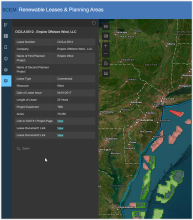
Renewable Energy Leases and Planning Areas Boundaries of renewable energy lease areas, wind planning areas, and marine hydrokinetic planning areas (last file update on 02/05/2025).
| ||||||||
Renewable Energy Wind Planning Areas, Wind Energy Areas and Leasing Areas Offshore Wind Lease Proposed or Installed Facilities The following data has been made available to BOEM by the lessees commensurate with various planning documents for BOEM’s review. Those documents that have been made public and are showing these data are available through the following links when provided by the lessees. BOEM has concatenated the data together into single layers to represent the current proposed and installed facilities. All features shown, unless currently installed and operational are considered proposed and can change as project decisions are made. Because these layers change frequently, downloadable data is only available through ArcGIS Online, where the public services are posted. ArcGIS Online offers free account setup for those that do not already have a personal or enterprise account. Go to “Sign In” and at the bottom of the sign in page click on “Create an Account.” Any downloads will post to your account where you can then copy them to your hard drive. Links to publicly available feature services. Downloads available to those with ArcGIS Online Accounts. | ||||||||
Interactive BOEM Lease Maps |
BOEM Funded Studies |
Hourly Wind Speed Modeled wind speed developed by the National Renewable Energy Laboratory (NREL). The geospatial data are represented as points. Hourly wind speed values are stored in centroids of BOEM Aliquots in the Pacific and Atlantic Regions and BOEM Lease Blocks in the Gulf of America Region. Each download contains a geodatabase, metadata, and ArcGIS toolbox. The ArcGIS toolbox can be used to develop polygons from the points for cartographic purposes. |
Seabird Surveys - Pacific Continental Shelf Environmental Assessment (PaCSEA) Bird transect counts represented as density of birds (birds/sqkm) detected during the PaCSEA 2011-2012 aerial surveys. |
Fishing Closures (Pacific) Areas permanently or intermittent closed to fishing on the West Coast, 2015. |
New Jersey’s Recreational and Commercial Ocean Fishing Grounds Digital Conversion of a fishing grounds atlas published by the New Jersey Department of Environmental Protection in 1982 |
Compendium of Avian Occurrence Compilation of seabird observation datasets on the Atlantic Outer Continental Shelf. The data is housed at the National Oceanographic Data Center. |
Socio-Economic Impact of Outer Continental Shelf Wind Energy Development on Fishing in the U.S. Atlantic Summary of all Fishery Management Plan (FMP) rasters (2007-2017) combined in a single raster and expressed as mean annual revenue. This data, a product of the National Marine Fisheries Service Northeast Fisheries Science Center, was combined into a single raster file by BOEM for ease of use by users wanting to look at multiple years. Single year revenue intensity rasters for the years 2007-2017 summarized by Fishery Management Plan (FMP). 2018 Data from the ORIGINAL STUDY (2007-2012). Summarized by GEAR, STATE, PORT and SPECIES. FMP data for this time period are available at the above links. |
Anglers’ Guide to the United States Atlantic Coast Digital conversion of anglers’ atlases published by the National Marine Fisheries Service between 1974-1976 |
BOEM Developed Analysis |
AIS – BOEM Vessel Traffic Density Analysis 2011 (Pacific) Total number of vessels transiting each leasing aliquot during 2011 for the Pacific OCS and coastal waters |
AIS – BOEM Vessel Traffic Density Analysis 2011 (Atlantic) Total number of vessels transiting each leasing aliquot during 2011 for the Atlantic OCS and coastal waters |
AIS – BOEM Vessel Traffic Density Analysis 2010 (Atlantic) Total number of vessels transiting each leasing aliquot during 2010 for the Atlantic OCS and coastal waters |
AIS – BOEM Vessel Traffic Density Analysis 2009 (Atlantic) Total number of vessels transiting each leasing aliquot during 2009 for the Atlantic OCS and coastal waters |
Mid-Atlantic Wildlife Surveys Study areas and tracklines of recent (since 2005) wildlife surveys conducted on the Atlantic OCS |
Note to users: Data downloaded from this site is to be used for informational and planning purposes only.


